
Circular route: 30.42 km
Total ascent: 1175 m
Total descent: 1175 m
Altitude difference: 812 m
(Altitude from: 440 m to 1252 m)
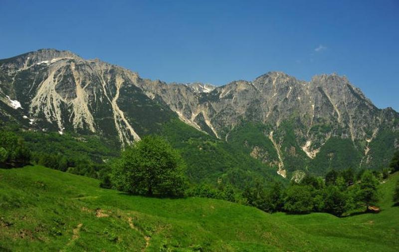
After a tasty and panoramic break, it is time to start cycling through the woods, up to the panoramic point on Montefalcone and the Small Dolomites. There is a very entertaining descent on gravel road and after that the path continues on asphalt to head towards the 'Montagnole e grandi alberi' route. Upon reaching the Casare Asnicar, you'll come across a wondrous scenery with an unparalled view that will take you back in time. The itinerary continues along the unpaved territory, with ups and downs that lead to the Battisti Refuge. Marco, the manager of the establishment (an old-fashioned manager, slightly grumpy but always available in every occasion) offers local dishes, sandwiches and beer. Now all that is left is a long and enjoyable descent that brings back to Recoaro Terme, passing through the Marzotto reservoir, Malga Lora and a cross track. The itinerary requires a lot of stamina, especially in the first part that leads to high altitude, but afterwards it is just fun and rewarding, for both the type of terrain and the scenery.

 nfo
nfo